The Map’s Greatest Deception: Why the Oak Island Treasure Might Be Hiding in Plain Sight
For over two centuries, the search for the Oak Island treasure has been guided by a single, unwavering assumption: the “Money Pit” is the heart of the mystery. Millions of dollars and generations of research have been poured into the eastern end of the island. However, as Rick and Marty Lagina delve deeper into ancient maps and overlooked symbols, a shocking possibility has emerged—the maps everyone followed may have been designed to lead searchers away from the truth.
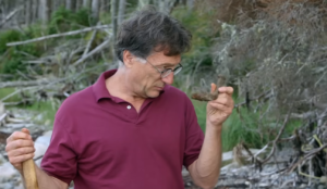
The latest breakthrough began on the “boulderless beach” on the northern shore. Following the theories of researcher Aaron Helton and an ancient French map, Steve Guptill and the team located a massive, out-of-place rock: the North Anchor Stone. This stone, carved with a cryptic “T” or cross-like symbol, is a near-perfect twin to an anchor stone found on the southern shore. According to Helton, these aren’t just random boulders; they are the fixed points of a landscape-sized mathematical puzzle. When triangulated using measurements from maps as old as the 14th century, the lines intersect at a point only three feet away from a massive steel shaft the team had already sunk.
This precision suggests a master plan that predates modern surveying. The search for a “why” has led the team to Westford, Massachusetts, where the famous “Boat Stone” sits. Carved with a ship and the number “184,” many believe this 250-pound boulder was a signpost left by the Scottish Templar Knight Henry Sinclair during a legendary voyage in 1398. If Sinclair used Oak Island to hide sacred relics—perhaps even the Ark of the Covenant—the markings on the Massachusetts stone may be the first step in a coastal treasure map leading directly to Nova Scotia.
The complexity of the mystery intensified with documents provided by the late Zena Halpern. Her collection included a map dated to 1179 AD, which used French labels like The Basin (the swamp) and The Marsh. Most tantalizing, however, were three labels for features never before confirmed: The Valve, The Anchors, and The Hatch. A note on the map explicitly stated, “The oak enter here,” pointing directly toward the Money Pit, but new evidence suggests the Pit may only be a decoy for a much larger underground system.
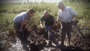
The most chilling confirmation of this theory came from the late Dave Blankenship. Far away from the famous digs in the east, Dave discovered a strange, square-shaped depression in the woods on the island’s western side. When Jack Begley overlaid Zena’s ancient map onto modern satellite imagery, the alignment was nearly perfect. The spot labeled as “The Hatch” fell precisely where Dave found the hole. Archeologist Laird Niven noted that the soil inside this depression was unusually loose, suggesting a man-made back door to a tunnel network that has remained untouched for centuries.

This shift to the west represents a monumental change in search strategy. If the Money Pit was a diversion, then the real vault—guarded by the geometry of the anchor stones and the Massachusetts boat stone—could be miles away from where anyone expected. Rick Lagina believes these “crumbs of evidence” are finally forming a clear direction. The hunt is no longer just about digging a hole; it is about solving a 700-year-old geometric puzzle. As the team moves toward the western lots to investigate “The Hatch,” the world is forced to consider a haunting question: Has the treasure been hiding in plain sight all along, protected by the very maps meant to reveal it?